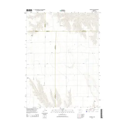
2014 Map of Wauneta SE
USGS Topo · Published 2014About this map
The high plains intersection of Chase, Hayes, Dundy, and Hitchcock counties dominates this landscape, defined by deep drainage systems and a rigid section-line road grid. The northern portion is characterized by the rugged dissection of Sand Canyon and Horse Canyon, while the southern reaches contain the headwaters of E Muddy Cr. These canyon systems provide the primary topographical relief in an otherwise strictly surveyed agricultural region.
Find a feature on this map
22 named features on this map. Tap any name to fly to it.
Don’t see what you’re looking for? This feature index may not catch every label — zoom into the map to look around manually.
Map Details
Editions of this 2014 Wauneta SE Map
This is the sole edition of this map. No revisions or reprints were ever made.
Other maps of this area

1954 · McCook
USGS Topo · 1:250,000

1957 · McCook
USGS Topo · 1:250,000

1958 · McCook
USGS Topo · 1:250,000

1962 · Stratton
USGS Topo · 1:24,000

1962 · Max NE
USGS Topo · 1:24,000

1973 · Wauneta SW
USGS Topo · 1:24,000
1973 · Rock Canyon
USGS Topo · 1:24,000

1973 · Palisade SW
USGS Topo · 1:24,000

1973 · Wauneta SE
USGS Topo · 1:24,000

1974 · Hamlet
USGS Topo · 1:24,000