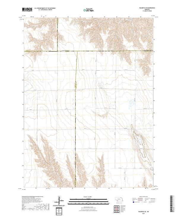
2021 Map of Wauneta SE
USGS Topo · Published 2021About this map
Deeply eroded drainages and a rigid grid of rural section roads define this portion of Southwest Nebraska, where the borders of Hitchcock, Dundy, Hayes, and Chase Counties converge. The landscape is characterized by prominent landforms such as Sand Canyon in the northeast and Milken Canyon in the southwest, revealing a terrain heavily shaped by seasonal water runoff. A network of local roads, including Ave 348, 8th Ave, and Rd 349, provides access through the agricultural and pastoral sections. This 2021 survey illustrates the precise intersection of several county lines, specifically where Co Line Rd marks the transition between Chase and Hayes. The layout reflects the enduring influence of the Public Land Survey System, with roads like Ave 347 and Rd 722 following section boundaries across the undulating prairie breaks near Horse Canyon.
Find a feature on this map
36 named features on this map. Tap any name to fly to it.
Don’t see what you’re looking for? This feature index may not catch every label — zoom into the map to look around manually.
Map Details
Editions of this 2021 Wauneta SE Map
This is the sole edition of this map. No revisions or reprints were ever made.
Other maps of this area

1954 · McCook
USGS Topo · 1:250,000

1957 · McCook
USGS Topo · 1:250,000

1958 · McCook
USGS Topo · 1:250,000

1962 · Stratton
USGS Topo · 1:24,000

1962 · Max NE
USGS Topo · 1:24,000

1973 · Wauneta SW
USGS Topo · 1:24,000
1973 · Rock Canyon
USGS Topo · 1:24,000

1973 · Palisade SW
USGS Topo · 1:24,000

1973 · Wauneta SE
USGS Topo · 1:24,000

1974 · Hamlet
USGS Topo · 1:24,000