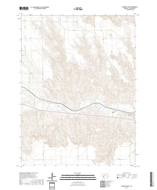
2021 Map of Wauneta West
USGS Topo · Published 2021About this map
Wauneta marks the primary center of activity in this portion of Chase County, situated along the southern boundary of the map. The village’s western extent is defined by W Wichita St, providing a clear look at the residential and local street layout of the modern era. Just northwest of the settlement lies Riverside Cem, a significant landmark for those tracing local family histories and genealogies in the region.
Find a feature on this map
23 named features on this map. Tap any name to fly to it.
Don’t see what you’re looking for? This feature index may not catch every label — zoom into the map to look around manually.
Map Details
Editions of this 2021 Wauneta West Map
This is the sole edition of this map. No revisions or reprints were ever made.
Other maps of this area

1954 · McCook
USGS Topo · 1:250,000

1957 · McCook
USGS Topo · 1:250,000

1958 · McCook
USGS Topo · 1:250,000

1973 · Enders
USGS Topo · 1:24,000

1973 · Ough
USGS Topo · 1:24,000

1973 · Wauneta SW
USGS Topo · 1:24,000

1973 · Wauneta SE
USGS Topo · 1:24,000

1973 · Imperial Municipal Airport
USGS Topo · 1:24,000

1974 · Dittons Creek SE
USGS Topo · 1:24,000
1974 · Wauneta West
USGS Topo · 1:24,000