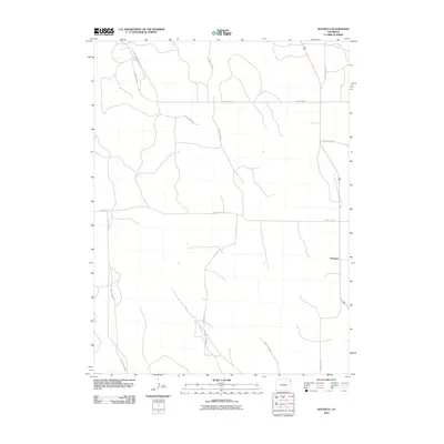
2010 Map of Wauneta
USGS Topo · Published 2010About this map
Wauneta serves as the primary focal point of this agricultural landscape in northeastern Colorado. The area is defined by a rigorous grid of section lines and rural arteries, including County Rd 54 and County Rd 51, which facilitate movement across the high plains. The map illustrates a classic Great Plains settlement pattern where small communities like Wauneta were established to serve the surrounding farming and ranching operations. Navigational landmarks are primarily structural, such as the intersection of County Road CC and County Road 88. This survey provides a clear view of the modern rural infrastructure, showing how family landholdings and farm-to-market access remain anchored by established routes like County Road FF and County Road AA.
Find a feature on this map
9 named features on this map. Tap any name to fly to it.
Don’t see what you’re looking for? This feature index may not catch every label — zoom into the map to look around manually.
Map Details
Editions of this 2010 Wauneta Map
This is the sole edition of this map. No revisions or reprints were ever made.
Other maps of this area

1954 · Sterling
USGS Topo · 1:250,000

1958 · Sterling
USGS Topo · 1:250,000

1971 · Alvin NW
USGS Topo · 1:24,000

1971 · Alvin SW
USGS Topo · 1:24,000

1971 · Fiddler Peak
USGS Topo · 1:24,000

1971 · Wauneta NE
USGS Topo · 1:24,000

1971 · Wauneta
USGS Topo · 1:24,000

1971 · Eckley NE
USGS Topo · 1:24,000
1971 · Wray NW
USGS Topo · 1:24,000

1971 · Old Baldy
USGS Topo · 1:24,000