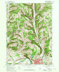
1969 Map of Waverly
USGS Topo · Published 1971About this map
The Chemung River valley and its surrounding ridges define this borderland landscape between New York and Pennsylvania. In the late 1960s, the village of Waverly serves as the primary hub, clustered with civic landmarks like the High Sch, Elm St Sch, and St James Sch. The industrial and transportation history of the region is evident in the parallel paths of the Lehigh Valley and Erie-Lackawanna railroads, which track the river and the Cayuta Creek corridor through North Waverly.
Find a feature on this map
54 named features on this map. Tap any name to fly to it.
Don’t see what you’re looking for? This feature index may not catch every label — zoom into the map to look around manually.
Map Details
Editions of this 1969 Waverly Map
3 editions found
Other maps of this area

1902 · Waverly
USGS Topo · 1:62,500

1903 · Owego
USGS Topo · 1:62,500

1905 · Watkins Glen
USGS Topo · 1:125,000

1906 · Catatonk
USGS Topo · 1:125,000

1923 · Towanda
USGS Topo · 1:62,500

1926 · Towanda
USGS Topo · 1:62,500

1939 · Sayre
USGS Topo · 1:62,500

1942 · Sayre
USGS Topo · 1:62,500

1943 · Towanda
USGS Topo · 1:62,500

1948 · Sayre
USGS Topo · 1:62,500