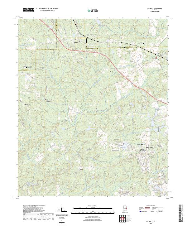
2024 Map of Waverly
USGS Topo · Published 2024About this map
Waverly and its surrounding rural hamlets sit at the intersection of Chambers, Lee, and Tallapoosa counties, exhibiting a landscape defined by small-scale agriculture and decentralized crossroads. The area is marked by numerous family and community burial grounds, such as the Maddox Family Cem and Canaan Cem, reflecting generations of local residency and kinships. Modern expansion from the south is evident where the northern reaches of Auburn meet the more traditional rural patterns of Ridge Grove and Jamesville.
Find a feature on this map
95 named features on this map. Tap any name to fly to it.
Don’t see what you’re looking for? This feature index may not catch every label — zoom into the map to look around manually.
Map Details
Editions of this 2024 Waverly Map
This is the sole edition of this map. No revisions or reprints were ever made.
Other maps of this area

1906 · Dadeville
USGS Topo · 1:125,000

1907 · Opelika
USGS Topo · 1:125,000

1909 · Opelika
USGS Topo · 1:125,000

1955 · Phenix City
USGS Topo · 1:250,000

1957 · Phenix City
USGS Topo · 1:250,000

1958 · Phenix City
USGS Topo · 1:250,000

1971 · Waverly
USGS Topo · 1:24,000
1971 · Moorefield
USGS Topo · 1:24,000
1971 · Opelika West
USGS Topo · 1:24,000

1971 · Loachapoka
USGS Topo · 1:24,000