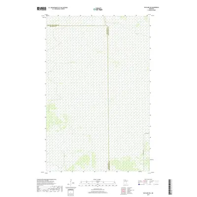
2019 Map of Wayland SW
USGS Topo · Published 2019About this map
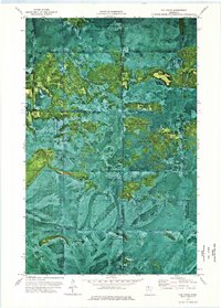
The boundary between Beltrami Co and Koochiching Co runs vertically through this northern landscape, marking a remote section of Minnesota wilderness. This 2019 survey documents a vast area dominated by wetlands and forested terrain, where human infrastructure is limited to a few persistent tracks through the brush. To the north, the line for Lake of the Woods Co defines the upper limit of the quadrangle. The few established transportation routes include Pine Island Rd and Forrest Road 96, which provide the primary access into these expansive lowlands. The map reveals the intricate network of the Public Land Survey System, including t156n r30w and t156n r29w, providing a clear grid for property research and land management in a region where few permanent settlements exist.
Find a feature on this map
10 named features on this map. Tap any name to fly to it.
Don’t see what you’re looking for? This feature index may not catch every label — zoom into the map to look around manually.
Map Details
Editions of this 2019 Wayland SW Map
This is the sole edition of this map. No revisions or reprints were ever made.
Other maps of this area

1919 · Fox
USGS Topo · 1:62,500

1919 · Norden
USGS Topo · 1:62,500

1919 · Knutson
USGS Topo · 1:62,500

1954 · Roseau
USGS Topo · 1:250,000

1957 · Roseau
USGS Topo · 1:250,000

1958 · Roseau
USGS Topo · 1:250,000
1973 · Ludlow Lookout Tower
USGS Topo · 1:24,000
1973 · Norman Lake
USGS Topo · 1:24,000
1973 · Wayland SW
USGS Topo · 1:24,000
1973 · The Pines
USGS Topo · 1:24,000