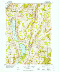
1953 Map of Wayne
USGS Topo · Published 1954About this map
Waneta Lake and Lamoka Lake dominate the central corridor of this survey, defining a narrow valley between the heights of Stocking Hill and House Hill. The 1953 field check captures the lakeside settlements of Wayne, Sylvan Beach, and Shorewood during a period of established shoreline development. Further south, the village of Tyrone serves as a local hub near the Tyrone Union Cemetery and District No 8 School, where Tobehanna Creek winds through the lowland terrain toward Mud Creek. Distinctive local place names like Gingerbread Corners and Six Nations reflect the intricate rural geography of the era. On the eastern ridges, the Sugar Hill Fire Tower stands as a prominent landmark overlooking the drainage of Little Tobehanna Creek, while the northern edge of the map touches the southern tip of Keuka Lake at the settlement of Keuka.
Find a feature on this map
46 named features on this map. Tap any name to fly to it.
Don’t see what you’re looking for? This feature index may not catch every label — zoom into the map to look around manually.
Map Details
Editions of this 1953 Wayne Map
2 editions found
Other maps of this area

1898 · Watkins Glen
USGS Topo · 1:62,500

1901 · Watkins
USGS Topo · 1:62,500

1902 · Ovid
USGS Topo · 1:62,500

1903 · Penn Yan
USGS Topo · 1:62,500

1903 · Hammondsport
USGS Topo · 1:62,500

1905 · Watkins Glen
USGS Topo · 1:125,000

1942 · Pulteney
USGS Topo · 1:31,680

1942 · Dundee
USGS Topo · 1:24,000

1942 · Keuka Park
USGS Topo · 1:24,000

1943 · Keuka Lake
USGS Topo · 1:31,680