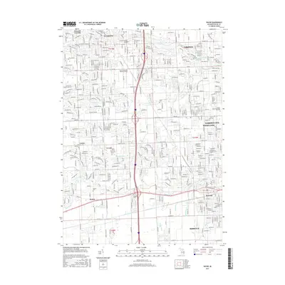
2017 Map of Wayne
USGS Topo · Published 2017About this map
Plymouth and Wayne anchor this suburban landscape, showing the dense residential expansion across Canton, Westland, and Livonia. The map highlights a complex hydrological network where Middle River Rouge feeds Newburgh Lake, while numerous local watercourses like Tonquish Creek and Fellows Cr are supported by an intricate system of municipal drains including Shuart Drain and Tuesdell Drain. This drainage infrastructure was essential for the transformation of this former agricultural land into a series of interconnected residential communities.
Find a feature on this map
98 named features on this map. Tap any name to fly to it.
Don’t see what you’re looking for? This feature index may not catch every label — zoom into the map to look around manually.
Map Details
Editions of this 2017 Wayne Map
This is the sole edition of this map. No revisions or reprints were ever made.
Other maps of this area

1902 · South Lyon
USGS Topo · 1:62,500

1902 · Ypsilanti
USGS Topo · 1:62,500

1904 · Ann Arbor
USGS Topo · 1:125,000

1905 · Wayne
USGS Topo · 1:62,500

1906 · Ypsilanti
USGS Topo · 1:62,500

1906 · South Lyon
USGS Topo · 1:62,500

1906 · Romulus
USGS Topo · 1:62,500

1908 · Ann Arbor
USGS Topo · 1:125,000

1912 · Wayne
USGS Topo · 1:62,500

1928 · Romulus
USGS Topo · 1:62,500
Featured Places
- Canton Charter Township, Canton Township
- Canton Township, MI
- Livonia, MI
- Westland, MI
- Van Buren Charter Township, MI