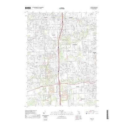
2023 Map of Wayne
USGS Topo · Published 2023About this map
The Lower River Rouge and Middle River Rouge define the hydrological character of this urbanized region in western Wayne County, where the historic communities of Plymouth, Wayne, and Westland converge. The landscape is heavily marked by an intricate network of drainage systems, including Hannan Drain and McKinstry Drain, which support the dense residential and industrial development between Canton and Garden City.
Find a feature on this map
51 named features on this map. Tap any name to fly to it.
Don’t see what you’re looking for? This feature index may not catch every label — zoom into the map to look around manually.
Map Details
Editions of this 2023 Wayne Map
This is the sole edition of this map. No revisions or reprints were ever made.
Other maps of this area

1902 · South Lyon
USGS Topo · 1:62,500

1902 · Ypsilanti
USGS Topo · 1:62,500

1904 · Ann Arbor
USGS Topo · 1:125,000

1905 · Wayne
USGS Topo · 1:62,500

1906 · Ypsilanti
USGS Topo · 1:62,500

1906 · South Lyon
USGS Topo · 1:62,500

1906 · Romulus
USGS Topo · 1:62,500

1908 · Ann Arbor
USGS Topo · 1:125,000

1912 · Wayne
USGS Topo · 1:62,500

1928 · Romulus
USGS Topo · 1:62,500
Featured Places
- Canton Charter Township, Canton Township
- Canton Township, MI
- Livonia, MI
- Westland, MI
- Van Buren Charter Township, MI