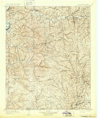
1905 Map of Waynesboro
USGS Topo · Published 1932About this map
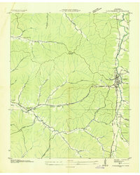
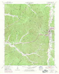
Waynesboro serves as the central hub of this 1905 survey, which covers the dissected terrain of Wayne County and the borderlands between Tennessee and Alabama. The geography is defined by a dense network of creek valleys and ridges, with the Buffalo River and Tennessee River shaping the northern and western margins. A significant historical element is the presence of the Natchez Trace, which winds through the eastern portion of the map, crossing paths with the Columbia Road. Local commerce and social life are reflected in the numerous small settlements and family-named landmarks such as Whittens Stand and McClaneys Stand. The southern edge reveals the industrial influence of the Sheffield Br railroad near Iron City, while rural life remains anchored to sites like Providence Church and Powells Mill. These landmarks illustrate a landscape transitioning from pioneer trails to established rural communities at the turn of the century.
Find a feature on this map
92 named features on this map. Tap any name to fly to it.
Don’t see what you’re looking for? This feature index may not catch every label — zoom into the map to look around manually.
Map Details
Editions of this 1905 Waynesboro Map
2 editions found

Historical Maps of Clifton Through Time
8 maps found