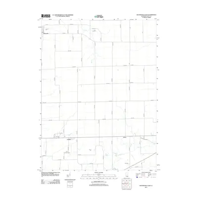
2012 Map of Waynesville East
USGS Topo · Published 2012About this map
Waynesville anchors the northwestern corner of this Illinois landscape, which transitions from the structured grid of the village into the expansive agricultural terrain of DeWitt County. The map reveals a high density of rural burial grounds, including Evergreen Cem, Rock Creek Cem, and McClimans Cem, suggesting a long-settled farming community with deep family roots. The presence of Hallsville and the settlement of Jenkins further southeast illustrates the distribution of small collection points once vital to the local economy.
Find a feature on this map
65 named features on this map. Tap any name to fly to it.
Don’t see what you’re looking for? This feature index may not catch every label — zoom into the map to look around manually.
Map Details
Editions of this 2012 Waynesville East Map
This is the sole edition of this map. No revisions or reprints were ever made.
Other maps of this area

1949 · Mc Lean
USGS Topo · 1:62,500

1951 · McLean
USGS Topo · 1:62,500

1951 · Le Roy
USGS Topo · 1:62,500

1957 · Kenney
USGS Topo · 1:62,500

1957 · Maroa
USGS Topo · 1:62,500

1958 · Peoria
USGS Topo · 1:250,000

1961 · Peoria
USGS Topo · 1:250,000

1963 · Peoria
USGS Topo · 1:250,000
1979 · Maroa
USGS Topo · 1:24,000
1979 · Clinton
USGS Topo · 1:24,000