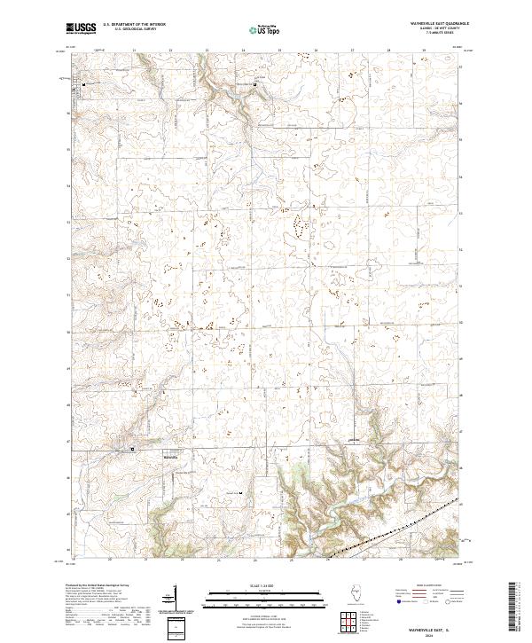
2024 Map of Waynesville East
USGS Topo · Published 2024About this map
Hallsville serves as a central anchor for this rural landscape in De Witt County, where a grid of section lines and country roads like Kickapoo Rd and Tabor Rd defines the agricultural layout. The terrain is marked by the winding courses of Rock Creek in the north and Tenmile Creek to the south, with Gibson Lakes providing a distinct hydrological feature near the lower boundary. Genealogists will find several burial sites preserved across the townships, including Evergreen Cem, Rock Creek Cem, McClimans Cem, and Barnett Cem. The inclusion of the Hooterville Airport north of Hallsville highlights the intersection of traditional farming communities with modern local aviation infrastructure. This survey illustrates a resilient Midwestern pattern of scattered farmsteads and small crossroads settlements connected by a dense network of county roads.
Find a feature on this map
58 named features on this map. Tap any name to fly to it.
Don’t see what you’re looking for? This feature index may not catch every label — zoom into the map to look around manually.
Map Details
Editions of this 2024 Waynesville East Map
This is the sole edition of this map. No revisions or reprints were ever made.
Other maps of this area

1949 · Mc Lean
USGS Topo · 1:62,500

1951 · McLean
USGS Topo · 1:62,500

1951 · Le Roy
USGS Topo · 1:62,500

1957 · Kenney
USGS Topo · 1:62,500

1957 · Maroa
USGS Topo · 1:62,500

1958 · Peoria
USGS Topo · 1:250,000

1961 · Peoria
USGS Topo · 1:250,000

1963 · Peoria
USGS Topo · 1:250,000
1979 · Maroa
USGS Topo · 1:24,000
1979 · Clinton
USGS Topo · 1:24,000