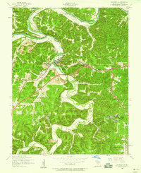
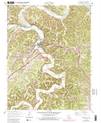
1954 Map of Waynesville
USGS Topo · Published 1959About this map
Waynesville serves as a focal point along the bends of Roubidoux Creek, where the transition from a river-based economy to a mid-century military and transport hub is evident. The landscape is dominated by the northern reaches of the Fort Leonard Wood Military Reservation and the Mark Twain National Forest, reflecting the significant federal presence in post-war Pulaski County. Local infrastructure is well-defined, ranging from the Waynesville Memorial Airfield and Waynesville General Hospital to the Sewage disposal plant and a Ball field, indicating a period of civic expansion.
Find a feature on this map
50 named features on this map. Tap any name to fly to it.
Don’t see what you’re looking for? This feature index may not catch every label — zoom into the map to look around manually.
Map Details
Editions of this 1954 Waynesville Map
5 editions found
Other maps of this area

1936 · Waynesville
USGS Topo · 1:48,000

1941 · Big Piney
USGS Topo · 1:62,500

1942 · Waynesville
USGS Topo · 1:62,500

1943 · Richland
USGS Topo · 1:62,500

1943 · Big Piney
USGS Topo · 1:62,500

1943 · Drynob
USGS Topo · 1:62,500

1944 · Waynesville
USGS Topo · 1:62,500

1954 · Springfield
USGS Topo · 1:250,000
1954 · Hancock
USGS Topo · 1:24,000

1954 · Drynob
USGS Topo · 1:62,500