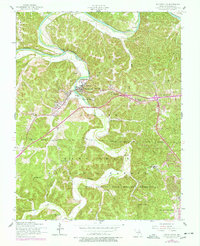
1954 Map of Waynesville
USGS Topo · Published 1977About this map
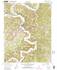
Roubidoux Creek meanders northward through this mid-century Missouri landscape, meeting the Gasconade River near the top of the sheet. The settlement of Waynesville serves as a central hub, situated where the creek widens near Roubidoux Spring. The area's transition from a rural river valley to a strategic military and transportation corridor is evident in the sprawling Fort Leonard Wood Military Reservation and the development of St Robert along the highway to the east.
Find a feature on this map
43 named features on this map. Tap any name to fly to it.
Don’t see what you’re looking for? This feature index may not catch every label — zoom into the map to look around manually.
Map Details
Editions of this 1954 Waynesville Map
5 editions found
Other maps of this area

1936 · Waynesville
USGS Topo · 1:48,000

1941 · Big Piney
USGS Topo · 1:62,500

1942 · Waynesville
USGS Topo · 1:62,500

1943 · Richland
USGS Topo · 1:62,500

1943 · Big Piney
USGS Topo · 1:62,500

1943 · Drynob
USGS Topo · 1:62,500

1944 · Waynesville
USGS Topo · 1:62,500

1954 · Springfield
USGS Topo · 1:250,000
1954 · Hancock
USGS Topo · 1:24,000

1954 · Drynob
USGS Topo · 1:62,500