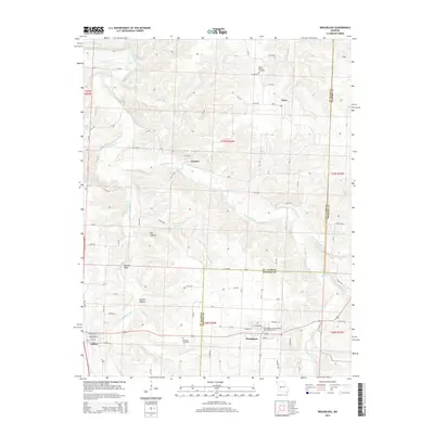
2015 Map of Weaubleau
USGS Topo · Published 2015About this map
Weaubleau serves as the primary population center for this section of Missouri, situated where the terrain begins its transition across the St. Clair Co Hickory Co line. The map illustrates a landscape defined by its winding waterways, including Weaubleau Cr and Little Weaubleau Cr, which have carved out notable landmarks like Boswell Bluff. For genealogists and local researchers, the presence of the Weaubleau Congregational Christian Cemetery, King's Prairie Cemetery, and Robinson Cemetery provides valuable physical links to the area's early families. Smaller settlements like Gerster, Terry, and Collins are connected by a web of rural roads, including several like SE 150 Rd and SE 900 Rd that trace the township and range lines. The topography reveals significant local features such as Possum Hollow and Big Hollow, reflecting a region shaped by natural drainage and agricultural development.
Find a feature on this map
47 named features on this map. Tap any name to fly to it.
Don’t see what you’re looking for? This feature index may not catch every label — zoom into the map to look around manually.
Map Details
Editions of this 2015 Weaubleau Map
This is the sole edition of this map. No revisions or reprints were ever made.
Other maps of this area

1884 · Bolivar
USGS Topo · 1:125,000

1886 · Stockton
USGS Topo · 1:125,000

1887 · Clinton
USGS Topo · 1:125,000

1887 · Warsaw
USGS Topo · 1:125,000

1892 · Bolivar
USGS Topo · 1:125,000

1894 · Warsaw
USGS Topo · 1:125,000

1894 · Clinton
USGS Topo · 1:125,000

1938 · Vista
USGS Topo · 1:24,000

1939 · Osceola
USGS Topo · 1:24,000

1939 · Arnica
USGS Topo · 1:24,000