
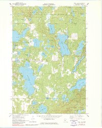
1970 Map of Webb Lake
USGS Topo · Published 1972About this map
Chippewa National Forest dominates the landscape of this Cass County region, where dense woodlands are broken by a complex network of glacial lakes and rivers. The hydrological pattern is anchored by the sprawling Webb Lake and Pleasant Lake, which are connected by the winding Boy River. This 1970 field-checked survey reveals a quiet, resource-oriented landscape defined by seasonal access and conservation boundaries. Notable landmarks include the Radio Tower (KNMT-TV) near Birch Lake, and scattered gravel pits that point to local infrastructure maintenance. Smaller water bodies like Stony Lake, Larson Lake, and Paquet Lake are interconnected by minor drainage ways, reflecting a wilderness area largely managed for forestry and recreation during the late twentieth century.
Find a feature on this map
52 named features on this map. Tap any name to fly to it.
Don’t see what you’re looking for? This feature index may not catch every label — zoom into the map to look around manually.
Map Details
Editions of this 1970 Webb Lake Map
2 editions found
Other maps of this area

1953 · Brainerd
USGS Topo · 1:250,000

1954 · Bemidji
USGS Topo · 1:250,000

1957 · Brainerd
USGS Topo · 1:250,000

1957 · Bemidji
USGS Topo · 1:250,000

1958 · Bemidji
USGS Topo · 1:250,000

1958 · Brainerd
USGS Topo · 1:250,000

1965 · Brainerd
USGS Topo · 1:250,000

1970 · Backus
USGS Topo · 1:24,000

1970 · Hackensack
USGS Topo · 1:24,000
1970 · Mildred
USGS Topo · 1:24,000