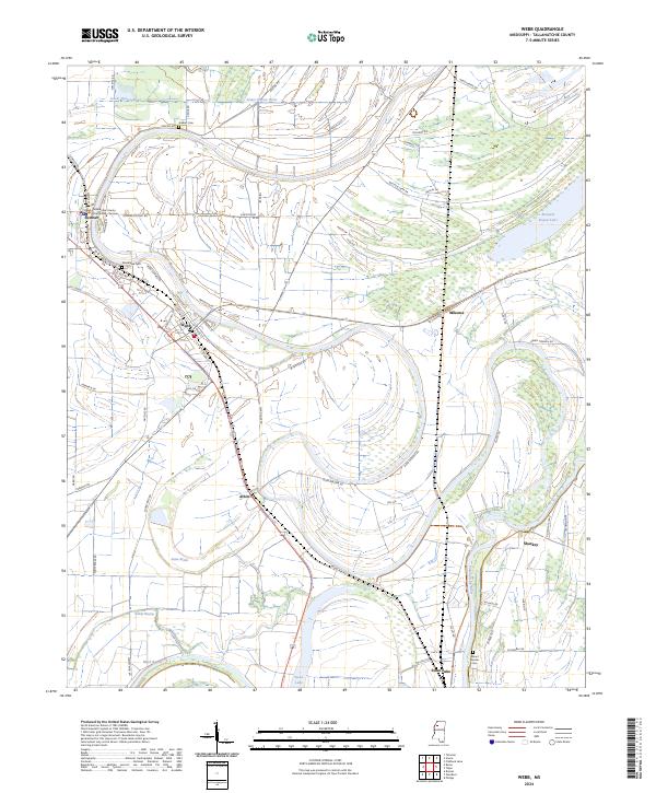
2024 Map of Webb
USGS Topo · Published 2024About this map
Sumner and Webb anchor this Mississippi Delta landscape, where the Tallahatchie River and Lower Quiver River wind through a complex network of oxbow lakes and wetlands. The presence of the Tallahatchie County Courthouse-Sumner highlights the importance of these river towns as administrative and social hubs. The terrain is marked by remnants of former river channels, now expressed as Snow Brake and Buzzard Bayou Lake, illustrating the natural evolution of the Delta floodplain.
Find a feature on this map
70 named features on this map. Tap any name to fly to it.
Don’t see what you’re looking for? This feature index may not catch every label — zoom into the map to look around manually.
Map Details
Editions of this 2024 Webb Map
This is the sole edition of this map. No revisions or reprints were ever made.
Other maps of this area

1931 · Sumner
USGS Topo · 1:48,000

1932 · Philipp
USGS Topo · 1:48,000

1932 · Tutwiler
USGS Topo · 1:48,000

1935 · Crowder
USGS Topo · 1:62,500

1935 · Sumner
USGS Topo · 1:62,500

1935 · Tutwiler
USGS Topo · 1:62,500

1935 · Philipp
USGS Topo · 1:62,500

1939 · Sumner
USGS Topo · 1:62,500

1939 · Crowder
USGS Topo · 1:62,500

1939 · Philipp
USGS Topo · 1:62,500