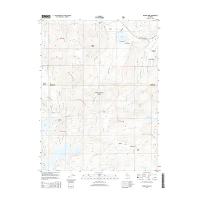
2015 Map of Webber Peak
USGS Topo · Published 2015About this map
Webber Peak and the high Sierra Nevada terrain of the Tahoe National Forest dominate this modern survey of the border between Sierra and Nevada counties. The map traces the historic Henness Pass Rd, a vital mid-19th-century emigrant and supply route crossing the crest at Henness Pass. This corridor, which once connected the California gold fields to the Comstock Lode, sits north of the modern Interstate 80 corridor, preserving a landscape of glacial lakes and alpine meadows. High-altitude water management is evident in the presence of Fordyce Lake, Meadow Lake, and Webber Lake, while the Pacific Crest National Scenic Trail winds through the western half of the quadrangle. The headwaters of the Little Truckee River and the Middle Yuba River originate in these drainages, illustrating the hydrological significance of the divide at Perazzo Canyon and Bear Valley.
Find a feature on this map
41 named features on this map. Tap any name to fly to it.
Don’t see what you’re looking for? This feature index may not catch every label — zoom into the map to look around manually.
Map Details
Editions of this 2015 Webber Peak Map
This is the sole edition of this map. No revisions or reprints were ever made.
Other maps of this area

1890 · Sierraville
USGS Topo · 1:125,000

1891 · Downieville
USGS Topo · 1:125,000

1891 · Colfax
USGS Topo · 1:125,000

1891 · Truckee
USGS Topo · 1:125,000

1892 · Sierraville
USGS Topo · 1:125,000

1892 · Colfax
USGS Topo · 1:125,000

1893 · Truckee
USGS Topo · 1:125,000

1893 · Downieville
USGS Topo · 1:125,000

1894 · Colfax
USGS Topo · 1:125,000

1894 · Sierraville
USGS Topo · 1:125,000