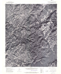
1972 Map of Webbers Falls NE
USGS Topo · Published 1974About this map
Tenkiller Ferry Lake dominates the southeastern quadrant of this orthophotomosaic, its flooded fingers reaching deep into the wooded draws of eastern Oklahoma. Prepared from 1972 aerial photography by the U.S. Geological Survey, this sheet provides a photographic record of the terrain character and land-use patterns just decades after the reservoir's creation. The landscape is a mix of dense forest and cleared parcels, with the small settlement of White Oak situated on the higher ground to the northeast. To the west, the stream of Greenleaf winds through the hills, illustrating the drainage patterns that define this section of the Cookson Hills region. The lack of dense road networks suggests a sparsely populated area where natural features and the rising waters of the lake dictate the local geography.
Find a feature on this map
3 named features on this map. Tap any name to fly to it.
Don’t see what you’re looking for? This feature index may not catch every label — zoom into the map to look around manually.
Map Details
Editions of this 1972 Webbers Falls NE Map
This is the sole edition of this map. No revisions or reprints were ever made.
Other maps of this area

1898 · Tahlequah
USGS Topo · 1:125,000

1901 · Muscogee
USGS Topo · 1:125,000

1901 · Tahlequah
USGS Topo · 1:125,000

1905 · Muscogee
USGS Topo · 1:125,000

1905 · Tahlequah
USGS Topo · 1:125,000

1946 · Fort Smith
USGS Topo · 1:250,000

1948 · Hulbert
USGS Topo · 1:62,500

1948 · Webbers Falls
USGS Topo · 1:62,500

1950 · Hulbert
USGS Topo · 1:62,500

1950 · Webbers Falls
USGS Topo · 1:62,500