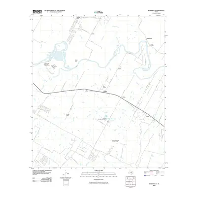
2010 Map of Webberville
USGS Topo · Published 2010About this map
The Colorado River winds through this central Texas landscape, shaping the development of rural communities east of Austin. Established settlements like Webberville, Garfield, and Hornsby Bend are interspersed with numerous family and community burial grounds, including Puckett Cemetery, Hunter Cemetery, and Woods Cemetery. The presence of Comanche Cemeteries near the riverbank speaks to the deeper history of the region. Significant twentieth-century infrastructure is visible, such as the City of Austin DBA Austin Energy Facility and the Del Valle Airport, marking the shift from a strictly agrarian economy to one supporting modern urban utility and transportation needs. Small water bodies like Clarence Washington Farm Lake, created by the Clarence Washington Farm Dam, reflect local land management and agricultural heritage along the drainage of Gilleland Creek and Onion Creek.
Find a feature on this map
62 named features on this map. Tap any name to fly to it.
Don’t see what you’re looking for? This feature index may not catch every label — zoom into the map to look around manually.
Map Details
Editions of this 2010 Webberville Map
This is the sole edition of this map. No revisions or reprints were ever made.
Other maps of this area

1885 · Bastrop
USGS Topo · 1:125,000

1893 · Bastrop
USGS Topo · 1:125,000

1896 · Austin
USGS Topo · 1:125,000

1897 · Austin
USGS Topo · 1:125,000

1904 · Bastrop
USGS Topo · 1:125,000

1910 · Austin
USGS Topo · 1:125,000

1948 · Elgin
USGS Topo · 1:62,500

1948 · Bastrop
USGS Topo · 1:62,500

1950 · Bastrop
USGS Topo · 1:62,500

1950 · Elgin
USGS Topo · 1:62,500