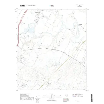
2019 Map of Webberville
USGS Topo · Published 2019About this map
The Colorado River meanders through this portion of East Travis County, shaping the communities of Hornsby Bend, Garfield, and Webberville. The landscape is defined by the river’s broad loops and its relationship with numerous tributaries like Gilleland Creek, Onion Creek, and Maha Cr. A high concentration of family and community burial grounds, including Puckett Cem, Hunter Cem, Haynie Cem, and Ingram Cem, indicates a deeply rooted local history and long-standing settlement patterns in the river valley. The map documents a mix of agricultural heritage, evidenced by the Clarence Washington Farm Lake, and modern residential expansion along the Travis Co Bastrop Co line. Transportation corridors such as Webberville Rd and Albert Brown Dr link these rural hubs, while the river's Hunter Bend remains a central geographic feature.
Find a feature on this map
100 named features on this map. Tap any name to fly to it.
Don’t see what you’re looking for? This feature index may not catch every label — zoom into the map to look around manually.
Map Details
Editions of this 2019 Webberville Map
This is the sole edition of this map. No revisions or reprints were ever made.
Other maps of this area

1885 · Bastrop
USGS Topo · 1:125,000

1893 · Bastrop
USGS Topo · 1:125,000

1896 · Austin
USGS Topo · 1:125,000

1897 · Austin
USGS Topo · 1:125,000

1904 · Bastrop
USGS Topo · 1:125,000

1910 · Austin
USGS Topo · 1:125,000

1948 · Elgin
USGS Topo · 1:62,500

1948 · Bastrop
USGS Topo · 1:62,500

1950 · Bastrop
USGS Topo · 1:62,500

1950 · Elgin
USGS Topo · 1:62,500