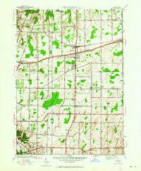
1952 Map of Webster
USGS Topo · Published 1964About this map
Webster and Penfield anchor this 1952 revision, illustrating a landscape of established orchards and growing residential corridors just east of the Rochester area. The map highlights the dominance of the New York Central railroad corridor and the significant natural footprint of the Thousand Acre Swamp, which separates the northern and southern settlements. Local history is deeply embedded in the rural infrastructure, from School No 5 to the industrial Quarry near the Penfield border. Genealogists will find value in the clearly marked Oakwood Cem and Smith Cem, while the inclusion of the Webster Beach County Park on the northern shoreline demonstrates the era's emerging focus on public recreation alongside traditional farming and transport routes like Ridge Road.
Find a feature on this map
57 named features on this map. Tap any name to fly to it.
Don’t see what you’re looking for? This feature index may not catch every label — zoom into the map to look around manually.
Map Details
Editions of this 1952 Webster Map
3 editions found
Other maps of this area

1895 · Rochester
USGS Topo · 1:62,500

1895 · Ontario Beach
USGS Topo · 1:62,500

1898 · Rochester
USGS Topo · 1:62,500

1899 · Ontario Beach
USGS Topo · 1:62,500

1900 · Macedon
USGS Topo · 1:62,500

1912 · Rochester
USGS Topo · 1:62,500

1912 · Ontario Beach
USGS Topo · 1:62,500

1920 · Rochester
USGS Topo · 1:62,500

1931 · Mendon Ponds
USGS Topo · 1:24,000

1931 · Rochester East
USGS Topo · 1:24,000