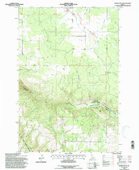
1994 Map of Weippe South
USGS Topo · Published 1997About this map
Weippe Prairie dominates the northern half of this Idaho landscape, where the town of Weippe serves as a central hub for the surrounding plateau. This mid-1990s survey preserves the route of the Lewis and Clark National Historic Trail as it winds through the timbered drainages of Jim Ford Creek and Schmidt Creek. The map documents a distinct transition from the open agricultural lands and named rural homesteads like Jacobson and Larson to the steep, wooded canyons of the Clearwater National Forest in the south.
Find a feature on this map
28 named features on this map. Tap any name to fly to it.
Don’t see what you’re looking for? This feature index may not catch every label — zoom into the map to look around manually.
Map Details
Editions of this 1994 Weippe South Map
This is the sole edition of this map. No revisions or reprints were ever made.
Other maps of this area

1924 · Kamiah
USGS Topo · 1:125,000

1924 · Weippe
USGS Topo · 1:125,000

1955 · Pullman
USGS Topo · 1:250,000

1956 · Hamilton
USGS Topo · 1:250,000

1958 · Pullman
USGS Topo · 1:250,000

1959 · Hamilton
USGS Topo · 1:250,000

1960 · Hamilton
USGS Topo · 1:250,000

1964 · Hamilton
USGS Topo · 1:250,000

1966 · Kooskia
USGS Topo · 1:24,000

1966 · Pierce
USGS Topo · 1:24,000