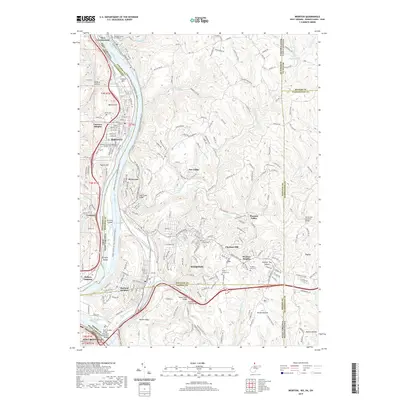
2019 Map of Weirton
USGS Topo · Published 2019About this map
Weirton and the industrial corridor of the Ohio River dominate this 21st-century survey, illustrating the complex geography where West Virginia, Ohio, and Pennsylvania converge. The map documents a dense network of neighborhoods including Marland Heights, Weircrest, and Weirton Heights, clustered around the river's bend and the large landform of Browns Island. Significant infrastructure like the Veteran's Memorial Bridge and the Robert Byrd Bridge facilitate movement across the state lines, while the Panhandle Rail-Trail follows the path of former industrial transit lines.
Find a feature on this map
76 named features on this map. Tap any name to fly to it.
Don’t see what you’re looking for? This feature index may not catch every label — zoom into the map to look around manually.
Map Details
Editions of this 2019 Weirton Map
This is the sole edition of this map. No revisions or reprints were ever made.
Other maps of this area

1901 · Beaver
USGS Topo · 1:62,500

1904 · Wellsville
USGS Topo · 1:62,500

1904 · Steubenville
USGS Topo · 1:62,500

1904 · Beaver
USGS Topo · 1:62,500

1904 · Burgettstown
USGS Topo · 1:62,500

1906 · Burgettstown
USGS Topo · 1:62,500

1935 · Steubenville
USGS Topo · 1:62,500

1937 · Wellsville
USGS Topo · 1:62,500

1942 · Steubenville
USGS Topo · 1:62,500

1944 · Wellsville
USGS Topo · 1:62,500