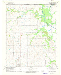
1971 Map of Welch North
USGS Topo · Published 1973About this map
Welch sits at the southwestern edge of this landscape, positioned along the Missouri - Kansas - Texas railroad line. The map highlights a rural interface between the Neosho River valley and the upland prairies, marked by the historical Old Indian Treaty Boundary that cuts diagonally across the northeastern sections. This boundary line serves as a reminder of the complex territorial history involving the Quapaw lands and surrounding tribal jurisdictions.
Find a feature on this map
30 named features on this map. Tap any name to fly to it.
Don’t see what you’re looking for? This feature index may not catch every label — zoom into the map to look around manually.
Map Details
Editions of this 1971 Welch North Map
This is the sole edition of this map. No revisions or reprints were ever made.
Other maps of this area

1886 · Joplin
USGS Topo · 1:125,000

1886 · Parsons
USGS Topo · 1:125,000

1893 · Parsons
USGS Topo · 1:125,000

1894 · Joplin
USGS Topo · 1:125,000

1901 · Vinita
USGS Topo · 1:125,000

1907 · Wyandotte
USGS Topo · 1:125,000

1909 · Wyandotte
USGS Topo · 1:125,000

1913 · Vinita
USGS Topo · 1:125,000

1918 · Columbus
USGS Topo · 1:62,500

1944 · Oswego
USGS Topo · 1:62,500