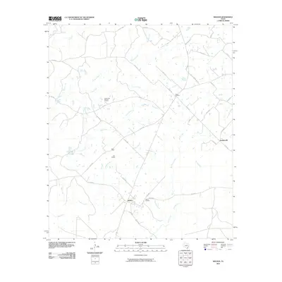
2010 Map of Weldon
USGS Topo · Published 2010About this map
Weldon and Sorghumville anchor this Houston County landscape, where the terrain is defined by a dense network of creek drainages including Kellisons Creek, Negro Creek, and Gardner Creek. The local history of the area is well-preserved through numerous named burial grounds such as the Adams-Little Memorial Cemetery and Salem Cemetery, which serve as vital markers for genealogical research in this rural pocket of East Texas. A distinctive local landmark, the Iron Bridge, spans the waters of Gardner Creek near Hazel Chapel. The map reveals a community structured around early roads like Neville's Prairie Rd and the prominent Hickory Hill Rd, illustrating how settlement patterns followed both the high ground and the meandering paths of waterways like Wright Creek and Sand Branch.
Find a feature on this map
43 named features on this map. Tap any name to fly to it.
Don’t see what you’re looking for? This feature index may not catch every label — zoom into the map to look around manually.
Map Details
Editions of this 2010 Weldon Map
This is the sole edition of this map. No revisions or reprints were ever made.
Other maps of this area

1953 · Palestine
USGS Topo · 1:250,000

1954 · Beaumont
USGS Topo · 1:250,000

1957 · Beaumont
USGS Topo · 1:250,000

1957 · Palestine
USGS Topo · 1:250,000

1960 · Trinity West
USGS Topo · 1:24,000

1962 · Lovelady South
USGS Topo · 1:24,000

1962 · Wyser Bottom
USGS Topo · 1:24,000

1962 · Baker Lake
USGS Topo · 1:24,000

1963 · Lovelady North
USGS Topo · 1:24,000

1964 · Sand Ridge
USGS Topo · 1:24,000