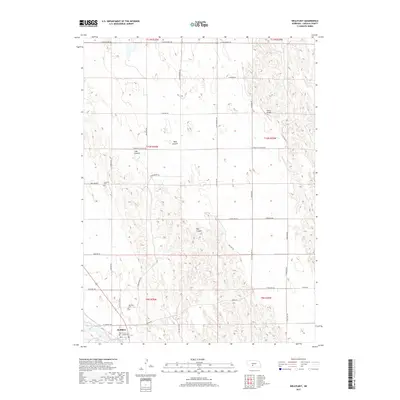
2017 Map of Wellfleet
USGS Topo · Published 2017About this map
Wellfleet serves as the primary hub in this portion of Lincoln County, situated near the waters of Wellfleet Lake. The town's grid is anchored by Tennessee St and W Somerset Rd, while the surrounding landscape is defined by the deep incisions of Well Canyon, Lake Canyon, and Hay Canyon. These geographic features dictate the rural road network, which includes historic routes like S Old Highway 83 and Burma Rd. For those researching local heritage, the Wellfleet Cem and Lutheran Cem provide tangible links to the area's early residents. Further north, the Detour Airport and the open expanse of Bell Prairie illustrate the transition from sheltered canyon floors to the high, windswept plains characteristic of this Nebraska region.
Find a feature on this map
37 named features on this map. Tap any name to fly to it.
Don’t see what you’re looking for? This feature index may not catch every label — zoom into the map to look around manually.
Map Details
Editions of this 2017 Wellfleet Map
This is the sole edition of this map. No revisions or reprints were ever made.
Other maps of this area

1954 · McCook
USGS Topo · 1:250,000

1956 · Wellfleet NW
USGS Topo · 1:24,000

1956 · White NE
USGS Topo · 1:24,000

1956 · Curtis NW
USGS Topo · 1:24,000

1956 · Curtis
USGS Topo · 1:24,000

1956 · Somerset
USGS Topo · 1:24,000

1956 · Wellfleet SE
USGS Topo · 1:24,000

1956 · Wellfleet
USGS Topo · 1:24,000

1956 · Wellfleet NE
USGS Topo · 1:24,000

1957 · McCook
USGS Topo · 1:250,000