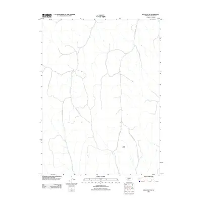
2011 Map of Wellfleet NE
USGS Topo · Published 2011About this map
Loess Plains terrain defines this portion of Lincoln County, Nebraska, where the landscape is carved by the winding course of Fox Creek. This digital-age survey captures a rural environment primarily organized around a sparse network of county roads that follow the natural topography and section lines of the central plains. These routes, including S Box Elder Rd and S Cottonwood Rd, provide the primary infrastructure for the region's agricultural homesteads and ranching operations. The map illustrates the characteristic drainage patterns of the plains, where small tributaries feed into the larger creek system, a vital resource in this semi-arid part of the state. Without concentrated town centers, the focus remains on the geography of the land and the primary arteries like Steffenbeck Rd that connect these remote sections.
Find a feature on this map
7 named features on this map. Tap any name to fly to it.
Don’t see what you’re looking for? This feature index may not catch every label — zoom into the map to look around manually.
Map Details
Editions of this 2011 Wellfleet NE Map
This is the sole edition of this map. No revisions or reprints were ever made.
Other maps of this area

1899 · North Platte
USGS Topo · 1:125,000

1902 · Gothenburg
USGS Topo · 1:125,000

1902 · North Platte
USGS Topo · 1:125,000

1954 · McCook
USGS Topo · 1:250,000

1954 · North Platte
USGS Topo · 1:250,000

1956 · North Platte
USGS Topo · 1:250,000

1956 · Jeffrey Reservoir SW
USGS Topo · 1:24,000

1956 · Wellfleet NW
USGS Topo · 1:24,000

1956 · Wellfleet SE
USGS Topo · 1:24,000

1956 · Wellfleet
USGS Topo · 1:24,000