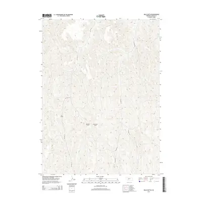
2014 Map of Wellfleet NE
USGS Topo · Published 2014About this map
Lincoln County landforms define this high plains landscape, where the dissection of the plateau has created a complex network of drainage systems. Cut Canyon, Box Elder Canyon, and Cottonwood Canyon represent the significant erosion patterns typical of this portion of Nebraska, cutting deep into the surrounding terrain. These natural features dictated the placement of early travel routes, seen today as Box Elder Rd and Cottonwood Rd, which often follow the ridges or valley floors to navigate the uneven elevation. To the southeast, the terrain softens slightly near the headwaters of Fox Cr, a small watercourse that drains the local watershed. This 2014 representation captures the balance between the persistent geographic obstacles of the canyons and the modern rural road network that facilitates movement through this sparsely populated agricultural region.
Find a feature on this map
8 named features on this map. Tap any name to fly to it.
Don’t see what you’re looking for? This feature index may not catch every label — zoom into the map to look around manually.
Map Details
Editions of this 2014 Wellfleet NE Map
This is the sole edition of this map. No revisions or reprints were ever made.
Other maps of this area

1899 · North Platte
USGS Topo · 1:125,000

1902 · Gothenburg
USGS Topo · 1:125,000

1902 · North Platte
USGS Topo · 1:125,000

1954 · McCook
USGS Topo · 1:250,000

1954 · North Platte
USGS Topo · 1:250,000

1956 · North Platte
USGS Topo · 1:250,000

1956 · Jeffrey Reservoir SW
USGS Topo · 1:24,000

1956 · Wellfleet NW
USGS Topo · 1:24,000

1956 · Wellfleet SE
USGS Topo · 1:24,000

1956 · Wellfleet
USGS Topo · 1:24,000