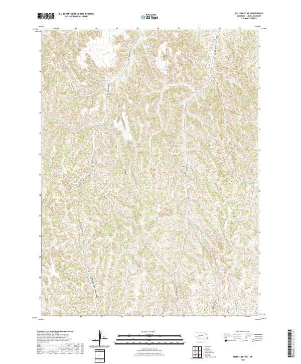
2021 Map of Wellfleet NE
USGS Topo · Published 2021About this map
Box Elder Canyon and Cottonwood Canyon dominate the topography of this Lincoln County landscape, showing the deeply etched drainage patterns characteristic of the Nebraska loess hills. This 2021 survey details a region defined by its vertical relief, where narrow ridgelines separate significant draws like Cut Canyon and the headwaters of Fox Cr. The transport network is tied strictly to these landforms, with routes such as S Box Elder Canyon Rd and S Cottonwood Canyon Rd following the natural contours of the canyon floors. Private land boundaries are marked by sectional lines, while specialized roads like Effenbeck Rd and S Effenbeck Rd provide access through the dissected terrain, illustrating how modern rural infrastructure adapts to the complex geography of the Great Plains.
Find a feature on this map
17 named features on this map. Tap any name to fly to it.
Don’t see what you’re looking for? This feature index may not catch every label — zoom into the map to look around manually.
Map Details
Editions of this 2021 Wellfleet NE Map
This is the sole edition of this map. No revisions or reprints were ever made.
Other maps of this area

1899 · North Platte
USGS Topo · 1:125,000

1902 · Gothenburg
USGS Topo · 1:125,000

1902 · North Platte
USGS Topo · 1:125,000

1954 · McCook
USGS Topo · 1:250,000

1954 · North Platte
USGS Topo · 1:250,000

1956 · North Platte
USGS Topo · 1:250,000

1956 · Jeffrey Reservoir SW
USGS Topo · 1:24,000

1956 · Wellfleet NW
USGS Topo · 1:24,000

1956 · Wellfleet SE
USGS Topo · 1:24,000

1956 · Wellfleet
USGS Topo · 1:24,000