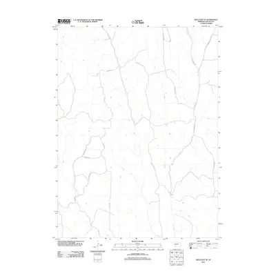
2011 Map of Wellfleet SE
USGS Topo · Published 2011About this map
Fox Creek winds through this sparsely settled corner of Lincoln County, defining the drainage patterns of a landscape marked by expansive section lines and rural thoroughfares. The 2011 survey reveals a road network deeply rooted in local topography and family heritage, where routes like S Ridge Rd and S Cottonwood Rd provide the primary access to this agricultural interior. The presence of S Mammoth Rd and E Mammoth Rd suggests a historical connection to the prominent geographic features of the region, while named paths such as E Hansen Hill Rd and S Effenbeck Rd offer clues for genealogists tracking local homesteads and land ownership in the early 21st century. This study is an essential tool for understanding the modern rural infrastructure before further development or consolidation of these historic corridors.
Find a feature on this map
13 named features on this map. Tap any name to fly to it.
Don’t see what you’re looking for? This feature index may not catch every label — zoom into the map to look around manually.
Map Details
Editions of this 2011 Wellfleet SE Map
This is the sole edition of this map. No revisions or reprints were ever made.
Other maps of this area

1902 · Gothenburg
USGS Topo · 1:125,000

1954 · McCook
USGS Topo · 1:250,000

1956 · Jeffrey Reservoir SW
USGS Topo · 1:24,000

1956 · Wellfleet NW
USGS Topo · 1:24,000

1956 · Moorefield
USGS Topo · 1:24,000

1956 · Curtis NW
USGS Topo · 1:24,000

1956 · Curtis
USGS Topo · 1:24,000

1956 · Wellfleet SE
USGS Topo · 1:24,000

1956 · Wellfleet
USGS Topo · 1:24,000

1956 · Wellfleet NE
USGS Topo · 1:24,000