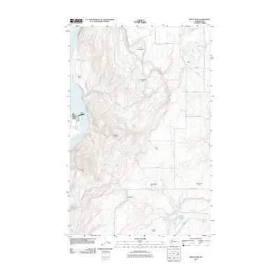
2011 Map of Wells Dam
USGS Topo · Published 2011About this map
Wells Dam anchors the western edge of this landscape, where the Columbia River cuts deep below the high plateau. The topography here is defined by dramatic elevation changes, rising from the riverbanks at Bonita Flats toward the expansive upper benches of Sourdough Flats and Boulder Park. This 2011 survey reveals a rural infrastructure of named farm roads and small settlements like Dyer and Howard, which are connected by a grid of routes such as D Rd NW and Old Dyer.
Find a feature on this map
37 named features on this map. Tap any name to fly to it.
Don’t see what you’re looking for? This feature index may not catch every label — zoom into the map to look around manually.
Map Details
Editions of this 2011 Wells Dam Map
This is the sole edition of this map. No revisions or reprints were ever made.
Other maps of this area

1905 · Okanogan
USGS Topo · 1:125,000

1953 · Ritzville
USGS Topo · 1:250,000

1954 · Okanogan
USGS Topo · 1:250,000

1957 · Bridgeport
USGS Topo · 1:62,500

1957 · Brewster
USGS Topo · 1:62,500

1958 · Okanogan
USGS Topo · 1:250,000

1959 · Ritzville
USGS Topo · 1:250,000

1965 · Ritzville
USGS Topo · 1:250,000

1968 · Chelan Falls
USGS Topo · 1:24,000

1968 · Chief Joseph Dam
USGS Topo · 1:24,000