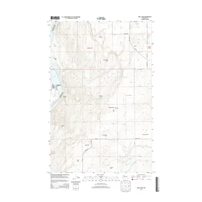
2014 Map of Wells Dam
USGS Topo · Published 2014About this map
Wells Dam spans the Columbia River at the western edge of this 2014 survey, where the river meets the southern reach of Lake Pateros. The surrounding Douglas County landscape is a high plateau marked by named depressions and rises, including Skeleton Canyon and the prominent Dyer Hill. Small settlements such as Dyer and Howard are connected by a network of rural roads like Dyer Hill Rd NW and Tanneburg Oil, reflecting the agricultural and ranching character of the region. The geography is punctuated by isolated water sources like Ford Spring and Pattie Big Spring, which remain vital landmarks in this arid terrain. Topographical features like Sourdough Flats and Boulder Park indicate the varying land use, from flat grazing areas to more complex geological formations like The Horseshoe and Cold Springs Basin.
Find a feature on this map
48 named features on this map. Tap any name to fly to it.
Don’t see what you’re looking for? This feature index may not catch every label — zoom into the map to look around manually.
Map Details
Editions of this 2014 Wells Dam Map
This is the sole edition of this map. No revisions or reprints were ever made.
Other maps of this area

1905 · Okanogan
USGS Topo · 1:125,000

1953 · Ritzville
USGS Topo · 1:250,000

1954 · Okanogan
USGS Topo · 1:250,000

1957 · Bridgeport
USGS Topo · 1:62,500

1957 · Brewster
USGS Topo · 1:62,500

1958 · Okanogan
USGS Topo · 1:250,000

1959 · Ritzville
USGS Topo · 1:250,000

1965 · Ritzville
USGS Topo · 1:250,000

1968 · Chelan Falls
USGS Topo · 1:24,000

1968 · Chief Joseph Dam
USGS Topo · 1:24,000