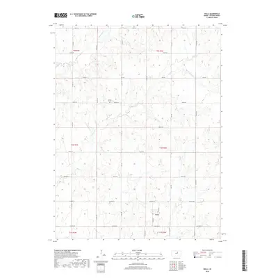
2018 Map of Wells
USGS Topo · Published 2018About this map
Wells serves as the central community in this portion of Ottawa County, situated among a network of rural routes that follow the section lines of the Public Land Survey System. The landscape is defined by the winding paths of Lindsey Cr and Sand Cr, which drain the undulating terrain between N 210th Rd and N 170th Rd. Genealogists will find the Pleasant Hill Cem near the intersection of Quartz Rd and N 180th Rd, a primary landmark for local family history. The drainage of Pipe Cr and Middle Pipe Cr in the northern reaches further illustrates the hydrological patterns that dictated early land use and road placement in this agricultural region.
Find a feature on this map
28 named features on this map. Tap any name to fly to it.
Don’t see what you’re looking for? This feature index may not catch every label — zoom into the map to look around manually.
Map Details
Editions of this 2018 Wells Map
This is the sole edition of this map. No revisions or reprints were ever made.
Other maps of this area

1891 · Clay Center
USGS Topo · 1:125,000

1892 · Minneapolis
USGS Topo · 1:125,000

1955 · Manhattan
USGS Topo · 1:250,000

1956 · Manhattan
USGS Topo · 1:250,000

1957 · Manhattan
USGS Topo · 1:250,000

1964 · Lamar
USGS Topo · 1:24,000

1964 · Miltonvale
USGS Topo · 1:24,000
1965 · Minneapolis South
USGS Topo · 1:24,000
1965 · Manchester NW
USGS Topo · 1:24,000

1965 · Minneapolis North
USGS Topo · 1:24,000