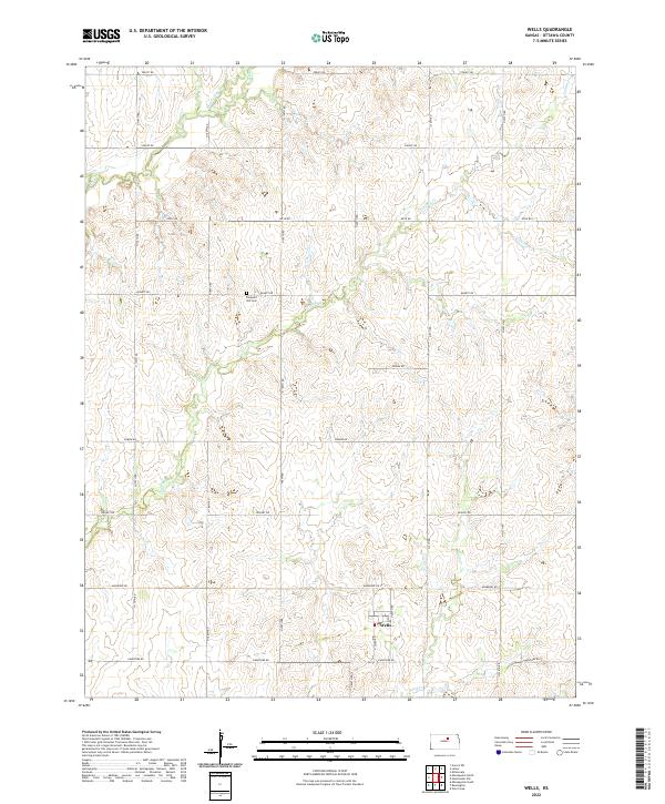
2022 Map of Wells
USGS Topo · Published 2022About this map
The small rural community of Wells sits in the southeastern portion of this landscape, characterized by the undulating agricultural plains of Ottawa County. The terrain is defined by the dendritic drainage patterns of Lindsey Cr and Sand Cr, which carve shallow valleys through the prairie. Settlement patterns follow a rigid section-line grid, as evidenced by local thoroughfares such as Treaty Rd, Quartz Rd, and Limestone Rd. For local historians and genealogists, the central landmark of Pleasant Hill Cem provides a significant point of reference for the early families of this township. The map illustrates a landscape of established farmsteads and agricultural persistence, where watercourses like Pipe Cr and Middle Pipe Cr remain the primary natural breaks in the geometric division of the Kansas prairie.
Find a feature on this map
21 named features on this map. Tap any name to fly to it.
Don’t see what you’re looking for? This feature index may not catch every label — zoom into the map to look around manually.
Map Details
Editions of this 2022 Wells Map
This is the sole edition of this map. No revisions or reprints were ever made.
Other maps of this area

1891 · Clay Center
USGS Topo · 1:125,000

1892 · Minneapolis
USGS Topo · 1:125,000

1955 · Manhattan
USGS Topo · 1:250,000

1956 · Manhattan
USGS Topo · 1:250,000

1957 · Manhattan
USGS Topo · 1:250,000

1964 · Lamar
USGS Topo · 1:24,000

1964 · Miltonvale
USGS Topo · 1:24,000
1965 · Minneapolis South
USGS Topo · 1:24,000
1965 · Manchester NW
USGS Topo · 1:24,000

1965 · Minneapolis North
USGS Topo · 1:24,000