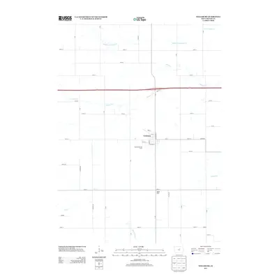
2013 Map of Wellsburg
USGS Topo · Published 2013About this map
Wellsburg serves as the central hub of this agricultural landscape in Grundy County, where a highly organized grid of range roads and township lines facilitates a legacy of Midwestern farming. The terrain is defined by the winding paths of S Beaver Cr and its various tributaries, including the Middle Fork S Beaver Cr and N Fork S Beaver Cr, which cut through the fertile till plains. Local landmarks like Tower Rock and the Meadowbrook Golf Course provide geographic points of interest within the expansive rural sections. The map records several outlying named locations such as Palermo, Herbert, and Highland, reflecting the persistent settlement pattern of small community clusters that once dotted the Iowa countryside. Modern infrastructure is represented by the heavy corridor of Highway 20, which bisects the northern half of the sheet.
Find a feature on this map
40 named features on this map. Tap any name to fly to it.
Don’t see what you’re looking for? This feature index may not catch every label — zoom into the map to look around manually.
Map Details
Editions of this 2013 Wellsburg Map
This is the sole edition of this map. No revisions or reprints were ever made.
Other maps of this area

1954 · Waterloo
USGS Topo · 1:250,000

1955 · Waterloo
USGS Topo · 1:250,000

1979 · Grundy Center
USGS Topo · 1:24,000

1979 · Holland
USGS Topo · 1:24,000

1979 · Ackley
USGS Topo · 1:24,000

1979 · Steamboat Rock
USGS Topo · 1:24,000

1979 · Eldora
USGS Topo · 1:24,000

1980 · Aplington
USGS Topo · 1:24,000

1980 · Wellsburg
USGS Topo · 1:24,000
1980 · Ivester
USGS Topo · 1:24,000