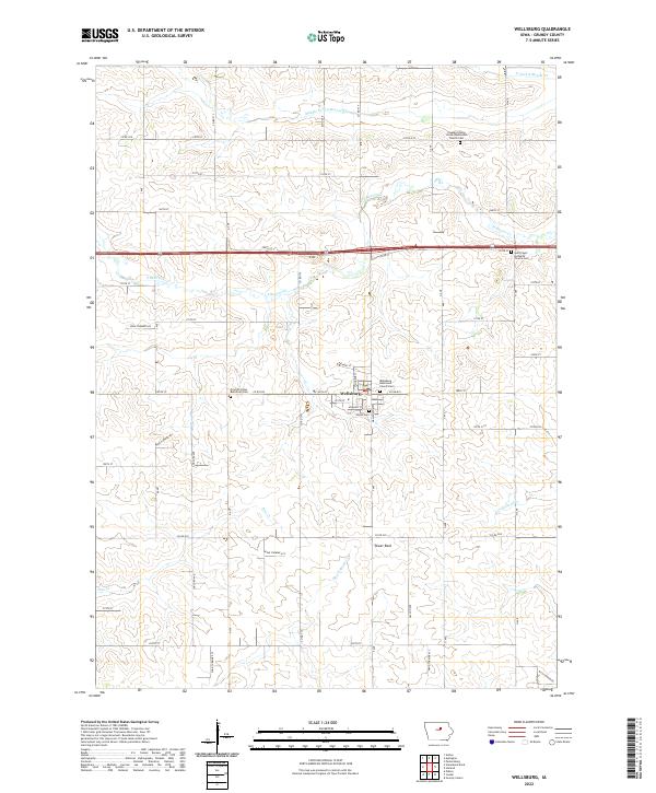
2022 Map of Wellsburg
USGS Topo · Published 2022About this map
Wellsburg sits at the heart of this Grundy County landscape, serving as a concentrated hub of settlement amidst a grid of agricultural sections and rolling prairie drainages. The area is defined by the headwaters of several notable Iowa waterways, including Middle Fork S Beaver Cr, S Beaver Cr, and Black Hawk Cr. For genealogists and local historians, the map is particularly valuable for its documentation of community burial grounds and religious centers, such as Shiloh Cem and the Wellsburg Reformed Church Cem. The terrain includes distinctive landmarks like Tower Rock and is increasingly marked by modern energy infrastructure, indicated by numerous Wind Turbine Acc points that reflect the evolution of the rural economy. The strict rectilinear road system, featuring routes like Co RD d25 and Co RD t19, highlights the enduring influence of the Public Land Survey System on this part of the state.
Find a feature on this map
46 named features on this map. Tap any name to fly to it.
Don’t see what you’re looking for? This feature index may not catch every label — zoom into the map to look around manually.
Map Details
Editions of this 2022 Wellsburg Map
This is the sole edition of this map. No revisions or reprints were ever made.
Other maps of this area

1954 · Waterloo
USGS Topo · 1:250,000

1955 · Waterloo
USGS Topo · 1:250,000

1979 · Grundy Center
USGS Topo · 1:24,000

1979 · Holland
USGS Topo · 1:24,000

1979 · Ackley
USGS Topo · 1:24,000

1979 · Steamboat Rock
USGS Topo · 1:24,000

1979 · Eldora
USGS Topo · 1:24,000

1980 · Aplington
USGS Topo · 1:24,000

1980 · Wellsburg
USGS Topo · 1:24,000
1980 · Ivester
USGS Topo · 1:24,000