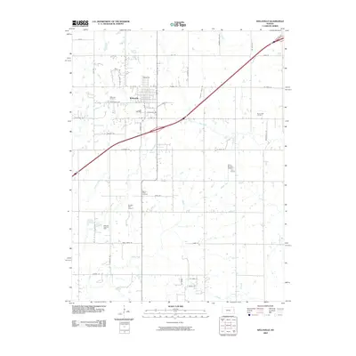
2009 Map of Wellsville
USGS Topo · Published 2009About this map
Wellsville serves as the primary hub for this eastern Kansas landscape, situated near the intersection of several notable drainage systems. The town is flanked by a network of local roads such as Pendleton Ave and Main St, while the surrounding countryside is marked by numerous family and community landmarks. Genealogists will find three significant burial grounds documented: Wellsville Cemetery, Walnut Creek Cemetery, and Rock Creek Cemetery.
Find a feature on this map
56 named features on this map. Tap any name to fly to it.
Don’t see what you’re looking for? This feature index may not catch every label — zoom into the map to look around manually.
Map Details
Editions of this 2009 Wellsville Map
This is the sole edition of this map. No revisions or reprints were ever made.
Other maps of this area

1885 · Lawrence
USGS Topo · 1:125,000

1887 · Olathe
USGS Topo · 1:125,000

1889 · Lawrence
USGS Topo · 1:125,000

1893 · Olathe
USGS Topo · 1:125,000

1947 · Lawrence
USGS Topo · 1:250,000

1950 · Lawrence
USGS Topo · 1:250,000

1956 · Wellsville
USGS Topo · 1:24,000

1956 · Le Loup
USGS Topo · 1:24,000
1956 · Edgerton
USGS Topo · 1:24,000

1956 · Lawrence
USGS Topo · 1:250,000