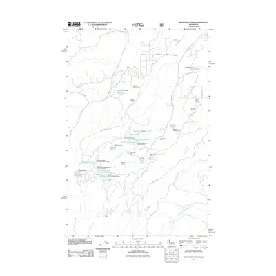
2011 Map of Wenatchee Heights
USGS Topo · Published 2011About this map
Wenatchee Heights and the surrounding orchards and plateaus above the Columbia River are defined by an intricate network of water management and rural settlement. This 2011 survey illustrates the intensive engineering required to sustain agricultural life on these high benches, featuring numerous named catchments like Mathison Reservoir, Greenwood Reservoir Number Two, and Spring Hill Reservoir. The landscape is etched by deep drainages including Squilchuck Creek and Stemilt Creek, which fall away from the Stemilt Basin.
Find a feature on this map
75 named features on this map. Tap any name to fly to it.
Don’t see what you’re looking for? This feature index may not catch every label — zoom into the map to look around manually.
Map Details
Editions of this 2011 Wenatchee Heights Map
This is the sole edition of this map. No revisions or reprints were ever made.
Other maps of this area

1912 · Malaga
USGS Topo · 1:48,000

1913 · Wenatchee
USGS Topo · 1:62,500

1914 · Malaga
USGS Topo · 1:62,500

1915 · Wenatchee
USGS Topo · 1:62,500

1920 · Colockum Pass
USGS Topo · 1:125,000

1922 · Colockum Pass
USGS Topo · 1:125,000

1957 · Wenatchee
USGS Topo · 1:250,000

1966 · Rock Island
USGS Topo · 1:24,000

1966 · Wenatchee
USGS Topo · 1:24,000
1966 · Colockum Pass
USGS Topo · 1:24,000