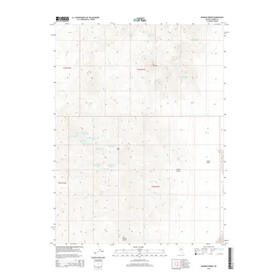
2014 Map of Wenban Spring
USGS Topo · Published 2014About this map
Mt Caetano and Bald Mtn dominate this high-desert landscape in central Nevada, where water sources are the primary markers of human and livestock activity. The map reveals a dense network of named springs, many bearing identifiers that suggest organized ranching or grazing divisions, such as Goyeneche Spring Number Seven and the uniquely named Spaghetti Number One Spring. These water points, including Wenban Spring and Woods Spring, were essential for survival in the arid terrain between Copper Canyon and the eastern edge of Grass Valley.
Find a feature on this map
29 named features on this map. Tap any name to fly to it.
Don’t see what you’re looking for? This feature index may not catch every label — zoom into the map to look around manually.
Map Details
Editions of this 2014 Wenban Spring Map
This is the sole edition of this map. No revisions or reprints were ever made.
Other maps of this area

1926 · Roberts Mountains
USGS Topo · 1:250,000

1929 · Roberts Mountains
USGS Topo · 1:250,000

1938 · Cortez
USGS Topo · 1:48,000

1944 · Cortez
USGS Topo · 1:62,500

1955 · Millett
USGS Topo · 1:250,000

1955 · Winnemucca
USGS Topo · 1:250,000

1956 · Walti Hot Springs
USGS Topo · 1:62,500

1956 · Hall Creek
USGS Topo · 1:62,500

1958 · Winnemucca
USGS Topo · 1:250,000

1959 · Millett
USGS Topo · 1:250,000