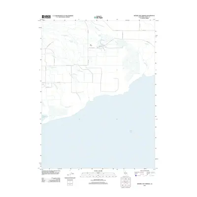
2012 Map of Wendel Hot Springs
USGS Topo · Published 2012About this map
Honey Lake dominates the southern reaches of this landscape, its northern shoreline met by a complex network of managed waterways and wetlands in eastern Lassen County. The hydrology of the area is defined by the Susan River and numerous sloughs, including Gelhooley Slough, Dill Slough, and Whitehead Slough, which weave through the flat terrain between Hartson Lake and the geothermal activity at Wendel Hot Springs. This 2012 survey illustrates the intricate irrigation and drainage systems developed for the region, characterized by the Tule Canal, Fleming Reservoir, and a long Levee that borders the wetlands. Local ranch roads and tracks such as Antola Rd and Viewland Rd provide access to this water-driven landscape, where the interplay of natural sloughs and constructed canals supports the agricultural and environmental needs of the basin.
Find a feature on this map
22 named features on this map. Tap any name to fly to it.
Don’t see what you’re looking for? This feature index may not catch every label — zoom into the map to look around manually.
Map Details
Editions of this 2012 Wendel Hot Springs Map
This is the sole edition of this map. No revisions or reprints were ever made.
Other maps of this area

1886 · Honey Lake
USGS Topo · 1:250,000

1891 · Honey Lake
USGS Topo · 1:250,000

1893 · Honey Lake
USGS Topo · 1:250,000

1950 · Milford
USGS Topo · 1:62,500

1954 · Wendel
USGS Topo · 1:62,500

1954 · Litchfield
USGS Topo · 1:62,500

1954 · Doyle
USGS Topo · 1:62,500

1955 · Westwood
USGS Topo · 1:250,000

1958 · Westwood
USGS Topo · 1:250,000

1959 · Westwood
USGS Topo · 1:250,000