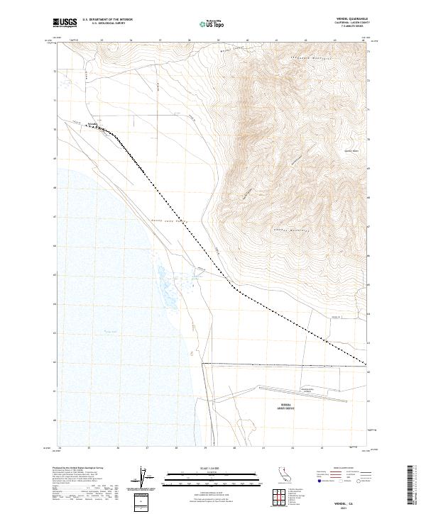
2021 Map of Wendel
USGS Topo · Published 2021About this map
Honey Lake dominates the southwestern quadrant of this Lassen County landscape, marking the transition from the high desert basin to the rising peaks of the Skedaddle Mountains and Amedee Mountains. The settlement of Wendel sits at a critical junction of local transport, where Wendel Rd, Antola Rd, and Amedee Rd converge near the foot of Wendel Canyon. This area illustrates the specialized military and aviation footprint in the California desert, anchored by the presence of Amedee Army Airfield in the southern reaches of the Honey Lake Valley. Topographic detail reveals a rugged environment defined by drainage systems like James Canyon and Amedee Canyon, while the northeastern corner shows the high-elevation terrain of Spencer Basin. The map captures the distinct spatial organization of this arid region, where vast valley floors are abruptly interrupted by steep volcanic mountain ranges.
Find a feature on this map
20 named features on this map. Tap any name to fly to it.
Don’t see what you’re looking for? This feature index may not catch every label — zoom into the map to look around manually.
Map Details
Editions of this 2021 Wendel Map
This is the sole edition of this map. No revisions or reprints were ever made.
Other maps of this area

1886 · Honey Lake
USGS Topo · 1:250,000

1891 · Honey Lake
USGS Topo · 1:250,000

1893 · Honey Lake
USGS Topo · 1:250,000

1950 · Milford
USGS Topo · 1:62,500

1954 · Wendel
USGS Topo · 1:62,500

1954 · Litchfield
USGS Topo · 1:62,500

1954 · Doyle
USGS Topo · 1:62,500

1955 · Westwood
USGS Topo · 1:250,000

1958 · Westwood
USGS Topo · 1:250,000

1959 · Westwood
USGS Topo · 1:250,000