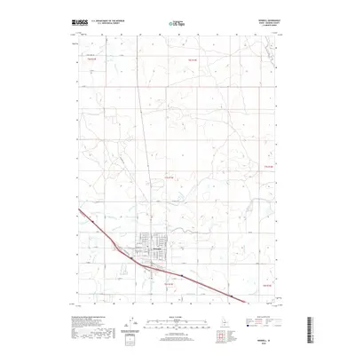
2020 Map of Wendell
USGS Topo · Published 2020About this map
Wendell serves as the central hub for this agricultural portion of the Magic Valley, characterized by a highly organized grid of irrigation channels. The local landscape is defined by an intricate network of waterways, including the W Canal and numerous laterals such as Lateral X-5 and Lateral W-34. This infrastructure underscores the region's reliance on managed water for its farm-based economy. The town site itself is meticulously planned, with residential streets like W Main St and 1st Ave E radiating from the core. Genealogists may find interest in the Wendell Cem located just west of the primary settlement. Beyond the town limits, rural thoroughfares such as Shoe String Rd and N Wendell Rd connect the outlying farmsteads, following the section lines of the Public Land Survey System.
Find a feature on this map
67 named features on this map. Tap any name to fly to it.
Don’t see what you’re looking for? This feature index may not catch every label — zoom into the map to look around manually.
Map Details
Editions of this 2020 Wendell Map
This is the sole edition of this map. No revisions or reprints were ever made.
Other maps of this area

1949 · Thousand Springs
USGS Topo · 1:24,000

1949 · Gooding Butte
USGS Topo · 1:24,000

1949 · Tuttle
USGS Topo · 1:24,000

1950 · Gooding Butte
USGS Topo · 1:24,000

1950 · Niagara Springs
USGS Topo · 1:24,000

1950 · Jerome
USGS Topo · 1:24,000

1950 · Jerome
USGS Topo · 1:62,500

1951 · Thousand Springs
USGS Topo · 1:24,000

1951 · Tuttle
USGS Topo · 1:24,000

1954 · Thousand Springs
USGS Topo · 1:24,000