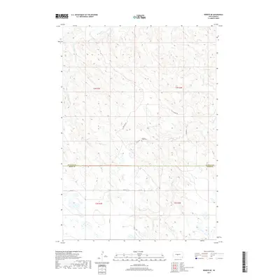
2017 Map of Wendte NE
USGS Topo · Published 2017About this map
The Mathews Family Cem sits along Aray Pl in this high-plains landscape where Jones and Stanley Counties meet. The terrain is defined by the dendritic drainage patterns of the Bad River and its numerous tributaries, including Crow Eagle Cr and the various branches of War Cr. While the region is largely open range, the road network follows the section lines of the Public Land Survey System, with routes like 224th St, Co Rd N 12, and Co Rd N 13 providing access to the remote homesteads and ranch lands. This 2017 survey reflects the enduring rural character of central South Dakota, where named landmarks like Soldier Rd and Warcreek Rd offer a sense of the local history and the intersection of traditional land use with modern geographic documentation.
Find a feature on this map
17 named features on this map. Tap any name to fly to it.
Don’t see what you’re looking for? This feature index may not catch every label — zoom into the map to look around manually.
Map Details
Editions of this 2017 Wendte NE Map
This is the sole edition of this map. No revisions or reprints were ever made.
Other maps of this area

1924 · Pierre
USGS Topo · 1:62,500

1937 · Oahe
USGS Topo · 1:62,500

1953 · Teton
USGS Topo · 1:24,000

1953 · Oahe SW
USGS Topo · 1:24,000

1953 · Pierre SW
USGS Topo · 1:24,000

1953 · Wendte
USGS Topo · 1:24,000

1953 · Wendte NE
USGS Topo · 1:24,000

1953 · Pierre 3 NW
USGS Topo · 1:24,000

1954 · Pierre
USGS Topo · 1:250,000

1958 · Pierre
USGS Topo · 1:250,000