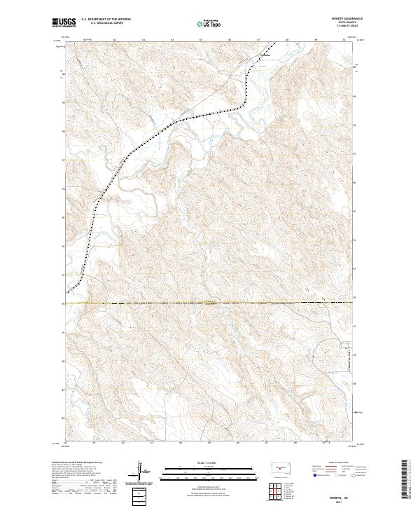
2021 Map of Wendte
USGS Topo · Published 2021About this map
Bad River meanders across this rural expanse of central South Dakota, defining the drainage patterns of a landscape marked by deep draws and named creek systems. The small settlement of Wendte is situated in the northeastern portion of the map along the river valley, where local travel is facilitated by rural routes like Bad River Rd and Bunkhouse Rd. The terrain is characterized by the confluence of several tributaries, including Plum Cr, White Clay Cr, and the extensive Herd Camp Cr, which flows northward across the boundary between Stanley and Jones counties. This 2021 survey illustrates the modern land divisions of the Public Land Survey System, including portions of Township 3 North, Range 28 East and adjacent ranges, showing the enduring grid of the American West.
Find a feature on this map
16 named features on this map. Tap any name to fly to it.
Don’t see what you’re looking for? This feature index may not catch every label — zoom into the map to look around manually.
Map Details
Editions of this 2021 Wendte Map
This is the sole edition of this map. No revisions or reprints were ever made.
Other maps of this area

1937 · Oahe
USGS Topo · 1:62,500

1951 · Van Metre
USGS Topo · 1:24,000

1951 · Capa SE
USGS Topo · 1:24,000

1953 · Teton
USGS Topo · 1:24,000

1953 · Oahe SW
USGS Topo · 1:24,000

1953 · Wendte
USGS Topo · 1:24,000

1953 · Wendte NE
USGS Topo · 1:24,000

1954 · Pierre
USGS Topo · 1:250,000

1958 · Pierre
USGS Topo · 1:250,000
1972 · Wendte SE
USGS Topo · 1:24,000