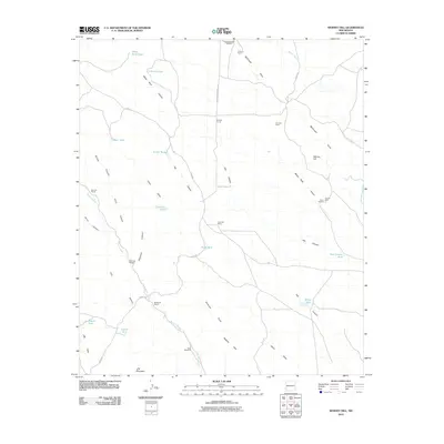
2010 Map of Werney Hill
USGS Topo · Published 2010About this map
Werney Hill and the Malpais Hills anchor this high-desert landscape in Grant County, defined by a network of drainage draws and ranching outposts. The terrain is marked by a legacy of mineral exploration and cattle operations, seen in sites like the Trimmer Mine, Werney Mine, and Hines Mine Deposit. Water management is central to life in this arid region, evidenced by the numerous tanks and windmills such as Patterson Windmill, Pete Windmill, and White Rock Tank that dot the map. These features are often situated along the winding paths of China Draw and Antelope Draw. Several family-named settlements and working structures like the Morrow Ranch, McDaniel Ranch, and Eubank Corral reveal the enduring cattle ranching patterns of New Mexico’s southwestern interior in the early 21st century.
Find a feature on this map
42 named features on this map. Tap any name to fly to it.
Don’t see what you’re looking for? This feature index may not catch every label — zoom into the map to look around manually.
Map Details
Editions of this 2010 Werney Hill Map
This is the sole edition of this map. No revisions or reprints were ever made.
Other maps of this area

1909 · Silver City
USGS Topo · 1:125,000

1949 · Whitewater
USGS Topo · 1:24,000

1950 · White Signal
USGS Topo · 1:24,000

1950 · Burro Peak
USGS Topo · 1:24,000

1951 · White Signal
USGS Topo · 1:24,000

1951 · Big Burro Mountains
USGS Topo · 1:24,000

1954 · Silver City
USGS Topo · 1:250,000

1958 · Silver City
USGS Topo · 1:250,000

1962 · Silver City
USGS Topo · 1:250,000

1962 · Ninetysix Ranch
USGS Topo · 1:24,000