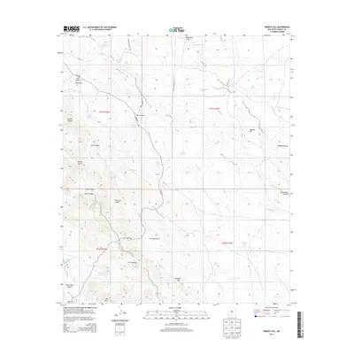
2013 Map of Werney Hill
USGS Topo · Published 2013About this map
Water management in the arid Southwestern landscape defines this area of Grant County, where a network of cattle tanks and draws supports ranching operations. Significant landmarks include Werney Hill, the Malpais Hills, and JPB Mtn, which punctuate a terrain carved by Patterson Canyon and Still Canyon. The map reveals a reliance on essential water sources such as White Rock Tank, Jonnie Tanks, and Arvin Tanks, each strategically placed near ephemeral drainages like McDonald Draw and Antelope Draw. Infrastructure is sparse, primarily consisting of unpaved ranch roads like Separ Rd and Jonnie Mcdonald RD that traverse the township boundaries. This 2013 survey provides a clear view of the geographic names and livestock improvements used by local landowners and ranchers in the early 21st century.
Find a feature on this map
35 named features on this map. Tap any name to fly to it.
Don’t see what you’re looking for? This feature index may not catch every label — zoom into the map to look around manually.
Map Details
Editions of this 2013 Werney Hill Map
This is the sole edition of this map. No revisions or reprints were ever made.
Other maps of this area

1909 · Silver City
USGS Topo · 1:125,000

1949 · Whitewater
USGS Topo · 1:24,000

1950 · White Signal
USGS Topo · 1:24,000

1950 · Burro Peak
USGS Topo · 1:24,000

1951 · White Signal
USGS Topo · 1:24,000

1951 · Big Burro Mountains
USGS Topo · 1:24,000

1954 · Silver City
USGS Topo · 1:250,000

1958 · Silver City
USGS Topo · 1:250,000

1962 · Silver City
USGS Topo · 1:250,000

1962 · Ninetysix Ranch
USGS Topo · 1:24,000