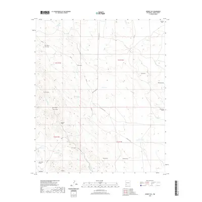
2020 Map of Werney Hill
USGS Topo · Published 2020About this map
The Malpais Hills and the prominent summit of JPB Mtn define this high-desert landscape in Grant County. Water management is the primary marker of human presence here, with a dense network of catchments such as White Rock Tank, Coon Den Tank, and Jonnie Tanks distributed across the terrain. These features reflect the area's grazing history and the necessity of capturing runoff in an arid environment. The map details a complex drainage system where Burro Cienaga and Walnut Cr cut through the hills. Transportation is limited to functional ranching and access routes, including Separ Rd and Johney Macdonald Rd, which navigate between the numerous canyons like Patterson Canyon and Still Canyon. The survey captures the topographic character of the region near Werney Hill during the early 21st century.
Find a feature on this map
38 named features on this map. Tap any name to fly to it.
Don’t see what you’re looking for? This feature index may not catch every label — zoom into the map to look around manually.
Map Details
Editions of this 2020 Werney Hill Map
This is the sole edition of this map. No revisions or reprints were ever made.
Other maps of this area

1909 · Silver City
USGS Topo · 1:125,000

1949 · Whitewater
USGS Topo · 1:24,000

1950 · White Signal
USGS Topo · 1:24,000

1950 · Burro Peak
USGS Topo · 1:24,000

1951 · White Signal
USGS Topo · 1:24,000

1951 · Big Burro Mountains
USGS Topo · 1:24,000

1954 · Silver City
USGS Topo · 1:250,000

1958 · Silver City
USGS Topo · 1:250,000

1962 · Silver City
USGS Topo · 1:250,000

1962 · Ninetysix Ranch
USGS Topo · 1:24,000