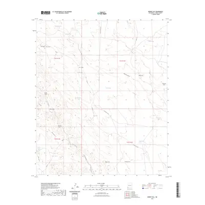
2023 Map of Werney Hill
USGS Topo · Published 2023About this map
Werney Hill rises above a high-desert landscape in Grant County, defined by a network of drainage draws and livestock watering tanks. The mapping of Burro Cienaga and various "tanks" like Coon Den Tank and Oak Canyon Tank highlights the critical role of water management for ranching in this arid environment. Transportation across the territory is facilitated by rural routes such as Johney Macdonald Rd and Separ Rd, which navigate the complex topography of the Malpais Hills and several significant canyons. Named features like Patterson Canyon and McDonald Draw suggest a history of local land use and family-settled landmarks. The presence of the Access Rd to Gage indicates modern utility and monitoring infrastructure within these traditional ranching lands.
Find a feature on this map
35 named features on this map. Tap any name to fly to it.
Don’t see what you’re looking for? This feature index may not catch every label — zoom into the map to look around manually.
Map Details
Editions of this 2023 Werney Hill Map
This is the sole edition of this map. No revisions or reprints were ever made.
Other maps of this area

1909 · Silver City
USGS Topo · 1:125,000

1949 · Whitewater
USGS Topo · 1:24,000

1950 · White Signal
USGS Topo · 1:24,000

1950 · Burro Peak
USGS Topo · 1:24,000

1951 · White Signal
USGS Topo · 1:24,000

1951 · Big Burro Mountains
USGS Topo · 1:24,000

1954 · Silver City
USGS Topo · 1:250,000

1958 · Silver City
USGS Topo · 1:250,000

1962 · Silver City
USGS Topo · 1:250,000

1962 · Ninetysix Ranch
USGS Topo · 1:24,000